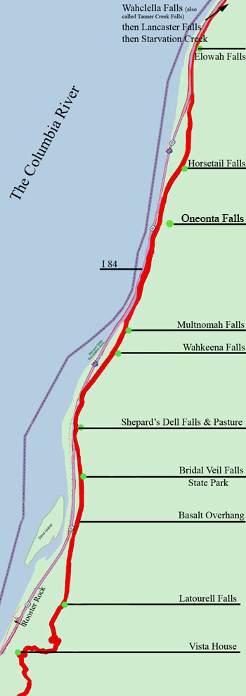
My apologies for
making this map with
EAST
at the top instead of
NORTH!!

This map shows the most popular section
of the Columbia River Highway.
As you travel from
Portland to The Dalles (starting at the bottom of the map) you first come
to Vista House, then Latourell Falls, then the Basalt Overhang showing
the difficulty in making this road and the rock work that bounds the steep
edge.
Bridal Veil Falls
State Park with it's unique cascading water and pungent woods is next.
Then Shepard's Dell Falls nestles in the bank. Next you pass Wahkeena
Falls and come to the most visited natural attraction in Oregon, Multnomah
Falls. A short walk off the highway brings you to Oneonta Falls,
then back to the Highway to see lacy Horsetail Falls and then Elowah Falls
at the top of the map.
Further east toward
the Dalles you reach Wahclella Falls (also known as Tanner Creek Falls),
then Lancaster Falls, then Starvation Creek.
The Historic Highway
continues between Mosier and the Dalles (and therefore not on the map)
bringing you to an interesting switchback road called Rowena Loop and
fine views of the Columbia River from Tom McCall Preserve and Dry Canyon.

Copyright 2007
Strength in Perspective
All Rights Reserved
Last Updated 7-11-2023