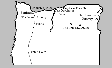

This Gallery is the Deschutes
Umatilla Plateau... Eastern Oregon's productive farmland. There
are both irrigated crops like "Hermiston Cantaloupe"
and dry land crops...the grains that spawn the
"Tractor in the Dust".
Columbia River aerial photos show the waters of the
Columbia providing for "Circle Irrigation"
. The colorful turbines of the "John Day Dam"
and The McNary Dam give electric power and passage for ships
headed up and down the Columbia.
Heavy
"Square Hay Bales" feed livestock;
"The Welder " keeps the balers
and tractors working to make those bales.
"Bearded Wheat"
is a common crop...in open plains or valleys like
"Tygh Valley" ... nestled in the hills.
The
"Sprinkler Man" must toil to
set his pipe and the crop duster must "Race the
Rain". Only then will the "Grain
Elevator" bulge by August. The
"Olex Schoolhouse 1880" bears testimony
to a very long history of people thriving in this area .
"Maupin Rafters" attest
to modern day fun!
The road on
"Emigrant Hill" brought
the people to Pendleton; the peaceful beauty of the
"Pendleton Hill's" and
"White River Falls"
and "The Hills of Athena"
shows why the people stayed!
Find this area on this map...


Copyright 2002
Strength in Perspective
All Rights Reserved
Last Updated 7-11-2023